There’s nothing like the feeling of lacing up your hiking boots and heading into the wonder and solace of the wild. Whether you’re looking for a leisurely hike ideal for the whole family, or a steep, technical hike to challenge your skills and increase your fitness levels, you’ll find an incredible variety of trails in the Harrison River Valley. If you’re wondering where to begin, here’s a list of five top hikes to get you started! We’re rating the difficulty from one pair (easy) to five pairs (difficult) of Sasquatch feet!
Things to remember:
- Check weather forecast before heading out;
- Always tell someone where you’re going and when you’ll be back;
- Pack water and snacks (and always pack out everything you packed in);
- Walking poles are a great idea to help you through steep sections;
- While hiking, make noise or wear a bell to alert wildlife of your presence.
1. SPIRIT TRAIL
DIFFICULTY: 👣 DISTANCE: 1km return TIME: 30 minutes
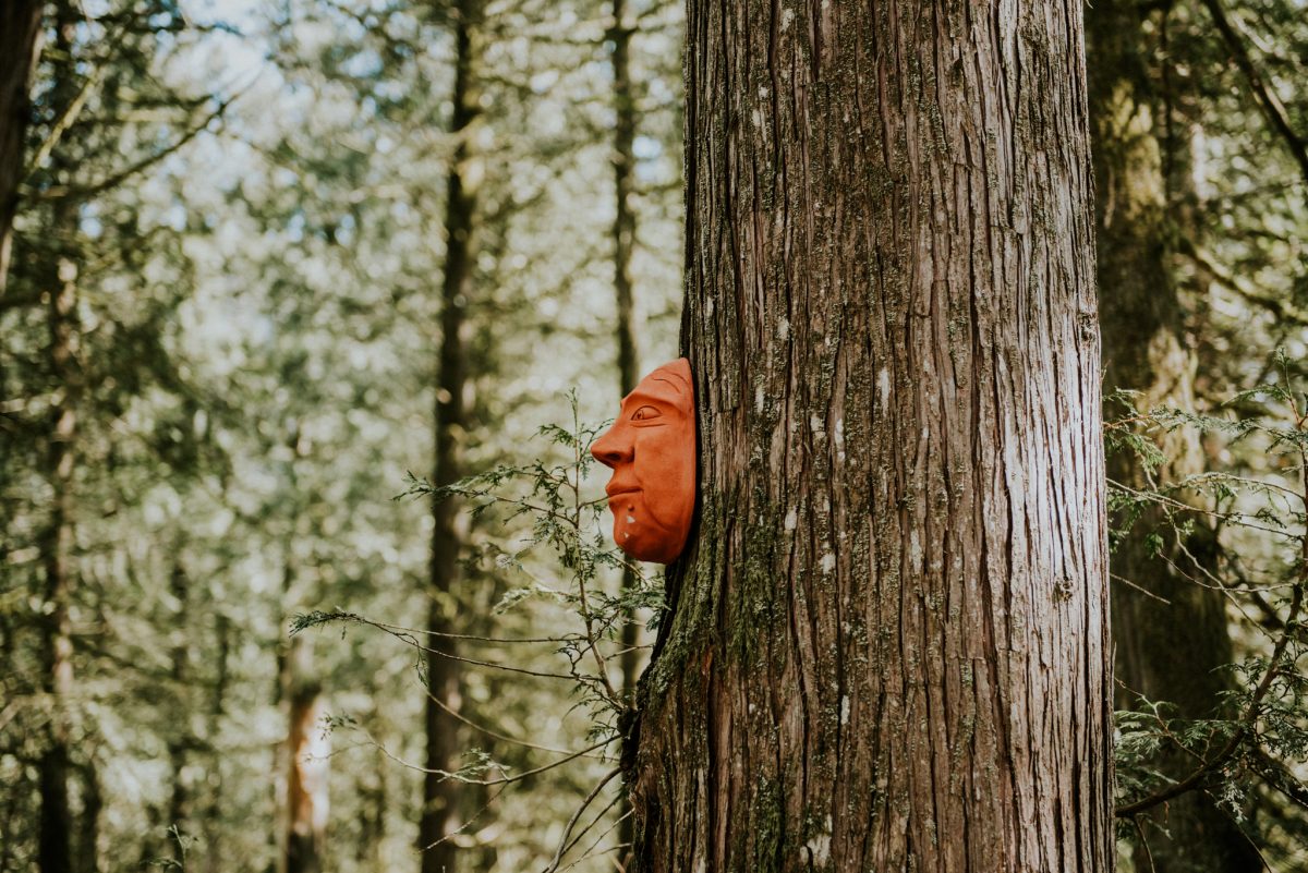
Trailhead: As you head into Harrison, turn right on McPherson Road, then left onto McCombs Drive. From there, it’s about 500 metres to the trailhead. You’ll love the lush green canopy and mossy forest floor that lend an ethereal feeling to this easy forest walk. Children especially love Spirit Trail, as there are several dozen whimsical clay masks created by a local artist, adorning trees along the walk. It gives the feeling of a treasure hunt as you find and keep count of how many masks you see along the way. Make your hike longer by continuing on to the longer Bridle Trail.
2. HICKS LAKE LOOP
DIFFICULTY: 👣 👣 DISTANCE: 7KM RETURN TIME: 2 HOURS
Trailhead: Head towards the village on Hot Springs Road, then turn right onto Lillooet Avenue and follow it through town; as it starts veering left it becomes Rockwell Drive. Continue on Rockwell, and when you reach a fork in the road, go right. Continue several km until you see the sign for Hicks Lake. It will be a right-hand turn there, continue and take your first left to the day-use area. There are two big parking lots here. Start your hike from the boat launch in the day-use area; the trail is on the right from the beach.
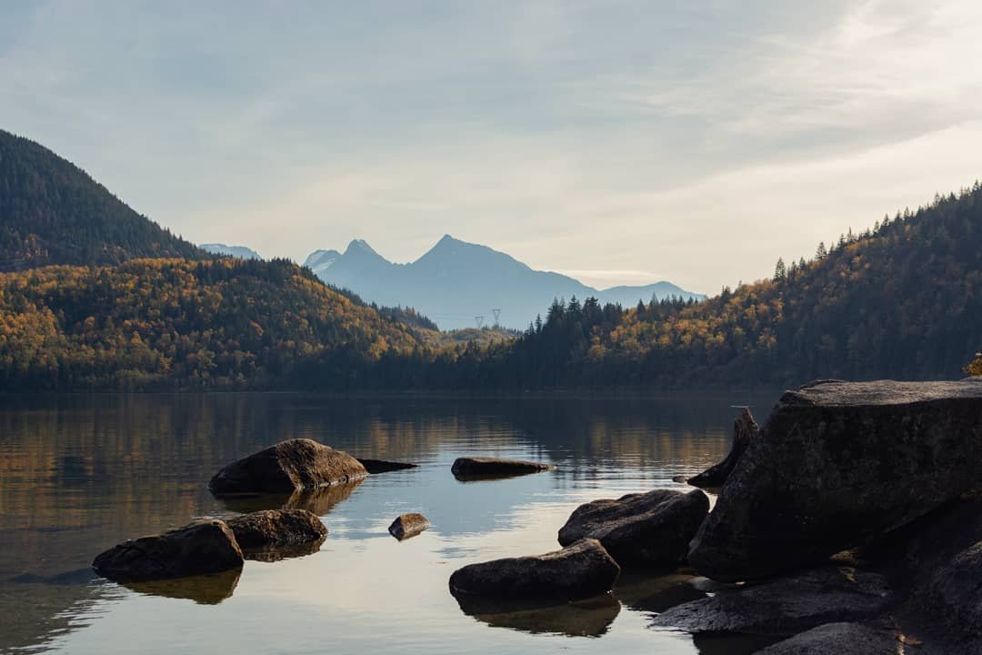
This lengthy loop offers a walk that’s easy for all ages and skill levels. The beginning of the hike hugs the shoreline, and a short distance later, you’ll come to a rocky outcropping that offers serene views of the lake. After you pass over a metal bridge, go left and follow the trail along the shore. You’ll also see a path that goes to the right, but that trail leads to the campsite area. The beauty of the Hicks Lake Loop is the wide range of terrain that you’ll encounter. Parts of the trail are along the shoreline, and it also weaves through mossy forests and crosses many wooden bridges that span small creeks. About halfway around is an idyllic little beach, a nice place to stop for a break and enjoy the view of the lake. The trail makes an entire loop around the lake, so it’s a great place to have a long, peaceful walk in nature and let your mind and body de-stress.
3. SANDY COVE & WHIPPOORWHILL POINT
DIFFICULTY: 👣 👣 👣 DISTANCE: 4KM RETURN TIME: 1.5 HOURS
Trailhead: To access this trail, park along the waterfront stalls on Esplanade Avenue, then walk the gravel trail that heads west past Harrison Hot Springs Resort. Continue past the building with the hot springs source and as you are almost at the end of the path you will see a trail to your left. It is marked with a yellow sign and starts off uphill.
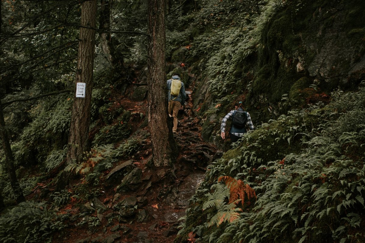
One of the highlights of this hike is the secluded beach known as Sandy Cove. For the most part, this trail isn’t very strenuous, but can be challenging for younger children as there are some steep sections, including a scramble over boulders partway up. Make sure to wear good hiking boots as there are many exposed tree roots and rocks that can be slippery. After the first steep sections and rugged rocks though, it’s smooth sailing as the trail continues onto a flatter worn path. Eventually, you’ll reach a T junction: this point is the beginning and end of the loop. Go right to get to the beautiful Sandy Cove beach. It’s often quiet (especially during off-season) as the only way to access this beach is the way you just came, or by boat. This area offers brilliant views of Harrison Lake and the expansive mountains. The trail continues at the far end of the beach. The rest of the path weaves its way through bountiful ferns and forests. At one point the trail climbs a small hill before dipping back down and follows alongside the Harrison River, and there’s a short trail that goes to a rocky bluff overlooking the river. The trail gets narrow in areas but other than the steep rocky start, it’s a relatively easy loop.
4. BEAR MOUNTAIN
DIFFICULTY: 👣 👣 👣 👣 DISTANCE: 18KM RETURN TIME: 6-7 HOURS
Trailhead: As you drive into Harrison Hot Springs, turn right at Lillooet Avenue. Drive for approximately 5 km, and when it starts to go up the east side of the lake, you’ll see a rough gravelly/grassy road on the right. Park here but don’t block any driveways (there are a few residences here).
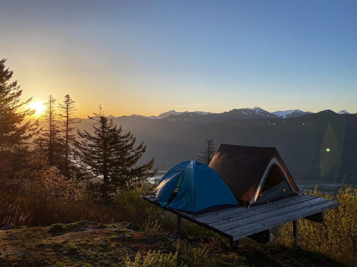
If you’re looking for a moderately challenging hike with some breathtaking views as reward, Bear Mountain is for you! Your walk begins on an old forest service road. You’ll see remnants of an old mining operation, and after you pass an old mining office, you’ll get to a fork in the road. At this point, take the trail on the right. Along this path, you’ll see some lovely small waterfalls and viewpoints. Then, you’ll gain plenty of elevation as you hike through a series of switchbacks. After about 2 hours of hiking, once you pass two talus slopes, you’ll get some incredible views of Harrison Lake and Harrison River. You’ll probably want to take a break here to savour the scenery and snap some pictures. As you continue, you’ll soon reach another intersection for Bear Lake to your right, and the trail to the Bear Mountain Lookout to the left. Stay left to get to the lookout. There is some slogging involved as the path is overgrown with deadfall and trees in some areas. At the top comes the reward: the forest opens up much like the heavens opening, and you’re greeted with spectacular, sweeping views of the Cheam Mountain Range, the Fraser Valley, Fraser River, and of course, Harrison Lake and Harrison River. This is a fantastic photo opportunity and a dazzling feast for the eyes!
5. CAMPBELL LAKE/HARRISON GRIND
DIFFICULTY: 👣 👣 👣 👣 👣 DISTANCE: 10KM RETURN TIME: 6 HOURS
Trailhead: Drive down Hot Springs Road until you are at Balsam Avenue on your right. Park at the turnout to your left; the trailhead is here.
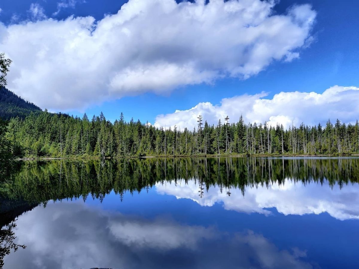
As this trail winds its way up Agassiz Mountain, it travels through a wide diversity of terrain. You’ll have to traverse some strenuous and sharp grades, and lots of rocky and rooted sections— so it’s not a trail for beginners. Start by following the gravel road up an incline to the water reservoir, then go left around it. Eventually, the trail leads into the forest, and as you travel, the terrain alternates between a wet and slippery creek bed and a packed trail. Soon, the trail narrows and you emerge out into the open and follow a boulder trail back into the forest. Eventually, you reach a moss-covered log bridge and will find more strenuous sections to climb before you come out to a flat area (known as the old helicopter landing pad). This is the spot where all your effort is rewarded! You’ll be met with incredibly dazzling views of Harrison Lake and the stunning rivers and mountain ranges that surround it. This is a great place to have a snack as you enjoy the mountain-fresh air and incredible scenery. If you decide to carry on to Campbell Lake, it’s another couple of kilometres, with a mossy boulder section to cross, stairs, and more slippery spots and roots. It’s a small, tranquil lake where, on a hot day, you might want to take a cool and refreshing dip. When you decide to head back down, walking poles will help immensely on the steep descent to take the pressure off your knees.
Have fun and be safe out there! For more outdoor inspiration, follow us on Facebook or Instagram, or stop into our Visitor Information Centre at 499 Hot Springs Road.




1 thought on “Top Hikes in the Harrison River Valley”
Comments are closed.